Showing posts with label Corregidor. Show all posts

Friday, August 20, 2010

Corregidor's Malinta Tunnel


Inside one of the laterals


Since yesterday was Quezon City Day, I'll do another post in honor of Manuel L Quezon - President of The Commonwealth Republic of the Philippines and the Founder of Quezon City and the historic Malinta Tunnel.

When the Japanese forces advanced and captured Manila, President Manuel L. Quezon and his family fled to Corregidor Island to evade the enemy.

This island was fortified by the Americans in the early 1990's to be the last standing ground of both the Filipino and American forces in the country. It has many batteries or gun emplacements strategically located all over the island to counter any marine or land attack by foreign invaders.

Malinta Tunnel is bombproof, has blowers that provides fresh air inside the tunnel and has a double line electric car line. It has 13 laterals on the north side and 11 on the south side. It has a 1000 bed hospital. The tunnel served as the headquarters of the United States Armed Forces in the Far East and became the storage facility of the island during the siege of Corregidor.

It became the house of Manuel L. Quezon and his family during his stay in the island and it was outside this tunnel that he made his 2nd term of Oath of Office as President of the Commonwealth together with Vice President Sergio Osmena.

Corregidor was not prepared for the aerial bombardment of the Japanese forces during the war. President Manuel L. Quezon reluctantly fled Corregidor in a submarine to begin his government in exile in New York, USA.


Thursday, May 27, 2010

The Spanish Lighthouse of Corregidor


Sorry, if most of my post this month has been about my Corregidor trip. I really enjoyed my travel there that I want to document every landmark that we've been to in the island.


As previosly mentioned in my other posts, the Spanish colonizers already used this island as part of its naval defenses. The island served as a penal institution thus it was named Corregidor from the spanish word " Corregir," which means to correct.


Most of the structures in Corregidor has been destroyed in World War II except for the Spanish Lighthouse. It was however severely damaged by the war that it was torn down and a new one was built in the 1950's.


The Spanish Lighthouse that is standing in Corregidor looks exactly like the original one on the same site where the old one has been built.


This charming structure with red roof and cross shaped windows is at the highest place in the island which is about 628 feet above sea level.


There's a Spanish Museum inside the lighthouse


The lighthouse has very steep stairs to reach the observation deck. It was a long and tiring climb to the top.


But the view from the observation desk is all worth it! It offers a panoramic view of Corregidor, South China Sea, Manila Bay and the provinces of Bataan and Cavite.


The sign post outside the lighthouse indicates how far and in what direction certain key cities are from Corregidor : San Francisco is 6,972 miles southwest of Corregidor, Australia is 3,044 miles north-northeast from the island while Hongkong is 692 miles south from Corregidor.


My other Corregidor's stories and their links:
* Our Corregidor Trip
* Corregidor Tour - Bottomside Landmarks
* Corregidor's Batteries and Barracks

Wednesday, May 19, 2010

Cine Corregidor


Before World War II broke out, the American personnel in the garrison and their families enjoyed watching movies in the island of Corregidor at this theater.


According to our tour guide, "Gone With The Wind," was one of the last movies shown here.


I was able to watch "Gone With The Wind," which starred Clark Gable and Vivien Leigh Moore because it was given as an assignment by our History teacher in highschool.


Cine Corregidor is at the left of the Pacific War Memorial.


This is one of my favorite pictures taken from the island because the shot turned out to beautiful even if it was taken while we were on a moving vehicle.


Thursday, May 13, 2010

Corregidor's Batteries and Barracks

This is the continuation of my Corregidor Island Tour
Because of Corregidor's strategic location which partially blocks the entrance of  Manila Bay, the Spanish colonizers already used this island as a naval defense against Chinese pirates, Dutch and British invaders.


During the American occupation of the Philippines, the American Government started fortifying the island with 23 batteries consisting of 56 coastal guns and mortars placed around Corregidor. It also has 13 anti-aircraft artillery batteries, 76 guns and 10 60-inch Sperry searchlights.


Corregidor's Batteries or Gun emplacements
- this batteries where named after American army officers who died in the country in the early 1900s. The following were some of the still intact batteries in Corregidor that we visited.

Battery Way and Battery Geary proved to be the most effective batteries in its campaign against the Japanese forces in World War II.
Battery Way - has four 12-inch mortars capable of firing 700 lbs shell in a distance 14,610 yards that can penetrate the thick wall of warships and against enemies in Bataan. A crew of 14 personnel was needed to fire the mortar and was equipped with anti-personnel firepower. The mortars of Battery Way continued firing until it frooze tight on May 6, 1942 when the Japanese took over Corregidor.


Entrance to Battery Way


The four mortars of Battery Way


bullet holes on one of the doors found in Battery Way


the holes on the walls of Battery Way caused by the heavy aerial bombing of the Japanese troops.


Battery Geary - eight-12 inch mortars made up this battery and this battery was considered to be the most effective anti-personnel firepower against enemies entreched at the mountains of Bataan. Each of the mortar was capable of firing a range of 14,610 yards at any direction.

It was directly hit by a Japanese bomb and all its crew died in an instant.

Battery Hearn - has a 12 inch seacost west-ranged gun, firing at approximately at 29,000 yards. It was found intact by the Japanese soldiers and was used by the Japanese force. But it was later on neutralized by the American aerial bombardments in April 1945.


Battery Crockett - has two 12 inch seacost gun mounted on a disappearing carriage. It was capable of firing at a range 17,000 yards and was capable of 170 degrees traverse. It is located at the center of the island and it fired often in the direction of Manila Bay.


The barracks just like the batteries were not restored to its original state after the war in order to show the destruction brought by the war and to honor the valiant men and women who fought and served in Corregidor.

Metal braces were put up on some of the structures to prevent the further degradation of the buildings.
From the ruins of the barracks you can have an idea on how heavy the fighting and bombing that occured in the island during WWII.

Middleside Barracks - made up of 2 three story building located at the Middleside of the Corregidor where the members of the 6oth Coast Artillery Regiment and the 91st Philippine Scout Coast Artillery Regiment were billeted, later it was occupied too by the 4th Marine Regiment.


Topside Barracks (Mile Long Barracks) - where the army officers and enlisted officers stayed. It is hurricane proof and is 1,520 feet long. It is less than a mile but this three story building is the world's longest barracks in the world during its time so it became known as the Mile Long Barracks. General Douglas MacArthur's headquarters can also be found here.


My other Corregidor's stories and their links:
* Our Corregidor Trip
* Corregidor Tour - Bottomside Landmarks

Tuesday, May 11, 2010

Our Corregidor Trip


I don't know why I had this sudden interest in visiting the Island of Corregidor. My parents visited it when they were in college many years ago and the only place they remembered was the Malinta Tunnel.


Perhaps because I had to ride a ferry to go to that island. I never had a ferry ride and it excites me to try how it is to be on it. And probably because I also enjoyed studying History during gradeschool and highschool. I want to put an image on the things I've read about in my History books.


It was not hard to convince my brother Paul to accompany me to visit it because my brother and I share the same interest in History, especially those that happened in World War II.


So we save up, bought our tickets and booked an island day tour at Corregidor through Sun Cruises, Inc.


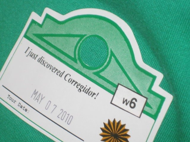
We woke up early on May 7,2010 and was at the Sun Cruises Offices at the CCP Bay Terminal before 7:00 am to get our tour stickers, boarding passes and buffet meal stubs. We rode a shuttle bus to where our ferry was docked.


I was a little apprehensive riding the ferry because of the many maritime accidents in the past but my fear was erased when I saw the Sun Cruiser II docked at the marina. It was a fairly large ferry.


The Sun Cruiser II was one of the two ferries of Sun Cruises Inc. that brings people to Corregidor. It can accomodate 285 passengers. It can travel at the speed of 23 knots. The cabin crew were courteous and they assisted us to our seats. We even have two marine marshals onboard our ferry.


As we sail off to Corregidor at a little past 8:00 am, the steward gave a demonstration on how to use our life jackets in case of emergency. It was a relief to see that on every seat there is a life jacket for the passenger unlike in the movie "Titanic" were the passengers fought each other for a life jacket. They also pointed to us where the emergency raft was.


As soon as all the safety precautions were said, my brother and I immedietely went to the upper deck to see the view of Manila Bay and to take pictures.


just a few minutes from the Manila Bay


When we got tired of all the picture taking session, we went back to our seats and watched the video presentation on Corregidor. After the film, Ed Baguio, one of Sun Cruises tour guides gave a history of Corregidor.

It was amazing to learn that Corregidor's history dates back to the Spanish era. Because of Corregidor strategic location and proximity to Manila Bay, the Spaniards already used Corregidor for her naval defenses against the Chinese pirates, Dutch and British Invaders.It is also called "The Rock" because of its rocky formation and fortifications.

The Americans started fortifying the island by installing guns and mortars and the Island became known as Fort Mills.


Because of its fortifications, Corregidor was the last to surrender to the Japanese forces that invaded the country.

The hour trip was a breeze and soon we were greeted by Corregidor with the Bataan Peninsula on its north and Cavite on its south. Geographically speaking, Corregidor is nearer to the province of Bataan but its interesting to note that the island is under the municipal jurisdiction of the province of Cavite.


The north dock of the island with the mountainous regions of Bataan on its North.


It was a low tide when we reached Corregidor so we have to disembarked through the upperdeck.


I was giddy with excitement when I saw the Tranvia buses that will take us to the different sights and historical landmarks of the Island.


The tranvia or the trams were the main mode of transportation in the island during the American Occupation of Corregidor.

We were on bus no. 3 with Kuya Bobby as our tourguide (the man with glasses leaning against the glass) and Kuya Jerry our bus driver. The bell on the left side of the tram rings when its time to visit another site.


I'll continue my post on Corregidor starting with the landmarks that can be found at the tail end of the Island.

My other Corregidor's stories and their links:

LinkWithin

Related Posts Plugin for WordPress, Blogger...